
Thank you for supporting this site ❤️
Make a donation
Make a donation
Hickory Bluff topographic map
Click on the map to display elevation.
Thank you for supporting this site ❤️
Make a donation
Make a donation
About this map
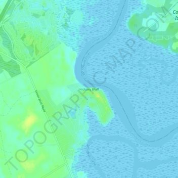
Name: Hickory Bluff topographic map, elevation, terrain.
Location: Hickory Bluff, Camden County, Georgia, United States (31.07190 -81.59066 31.11190 -81.55066)
Average elevation: 4 m
Minimum elevation: -1 m
Maximum elevation: 16 m
Thank you for supporting this site ❤️
Make a donation
Make a donation
Other topographic maps
Click on a map to view its topography, its elevation and its terrain.
Thank you for supporting this site ❤️
Make a donation
Make a donation
Thank you for supporting this site ❤️
Make a donation
Make a donation