
通桥街道 topographic map
Interactive map
Click on the map to display elevation.
About this map
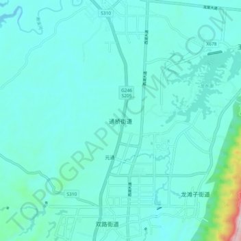
Name: 通桥街道 topographic map, elevation, terrain.
Location: 通桥街道, 大足区, 重庆市, 中国 (29.48155 105.72708 29.56155 105.80708)
Average elevation: 389 m
Minimum elevation: 326 m
Maximum elevation: 879 m
Other topographic maps
Click on a map to view its topography, its elevation and its terrain.