
綦江区 topographic map
Interactive map
Click on the map to display elevation.
About this map
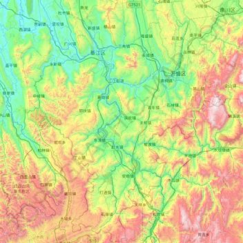
Name: 綦江区 topographic map, elevation, terrain.
Location: 綦江区, 重庆市, 中国 (28.45381 106.38203 29.18736 107.06025)
Average elevation: 813 m
Minimum elevation: 186 m
Maximum elevation: 2,035 m
Other topographic maps
Click on a map to view its topography, its elevation and its terrain.