
Engelberger Rotstock topographic map
Interactive map
Click on the map to display elevation.
About this map
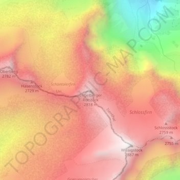
Name: Engelberger Rotstock topographic map, elevation, terrain.
Location: Engelberger Rotstock, Isenthal, Uri, 6461, Svizzera (46.85373 8.49777 46.85383 8.49787)
Average elevation: 2,375 m
Minimum elevation: 1,493 m
Maximum elevation: 2,879 m
Other topographic maps
Click on a map to view its topography, its elevation and its terrain.