
Brunnistock topographic map
Interactive map
Click on the map to display elevation.
About this map
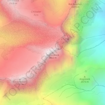
Name: Brunnistock topographic map, elevation, terrain.
Location: Brunnistock, Isenthal, Uri, 6461, Svizzera (46.84773 8.54995 46.84783 8.55005)
Average elevation: 2,306 m
Minimum elevation: 1,460 m
Maximum elevation: 2,932 m
Other topographic maps
Click on a map to view its topography, its elevation and its terrain.