
Thank you for supporting this site ❤️
Make a donation
Make a donation
Oil Nut Bay topographic map
Click on the map to display elevation.
Thank you for supporting this site ❤️
Make a donation
Make a donation
About this map
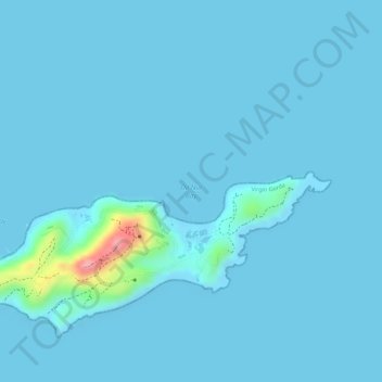
Name: Oil Nut Bay topographic map, elevation, terrain.
Location: Oil Nut Bay, British Virgin Islands (18.50281 -64.33047 18.50291 -64.33037)
Average elevation: 7 m
Minimum elevation: 0 m
Maximum elevation: 128 m
Thank you for supporting this site ❤️
Make a donation
Make a donation
Other topographic maps
Click on a map to view its topography, its elevation and its terrain.
Thank you for supporting this site ❤️
Make a donation
Make a donation
Thank you for supporting this site ❤️
Make a donation
Make a donation