
Cerro las tetas topographic map
Interactive map
Click on the map to display elevation.
About this map
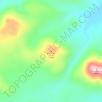
Name: Cerro las tetas topographic map, elevation, terrain.
Location: Cerro las tetas, Departamento Tolhuin, TDF, Argentina (-54.22150 -68.58009 -54.22140 -68.57999)
Average elevation: 331 m
Minimum elevation: 234 m
Maximum elevation: 542 m
Other topographic maps
Click on a map to view its topography, its elevation and its terrain.
Staten Island
Staten Island, Departamento Ushuaia, TDF, 9410, Argentina
Average elevation: 23 m