
昌江黎族自治县 topographic map
Interactive map
Click on the map to display elevation.
About this map
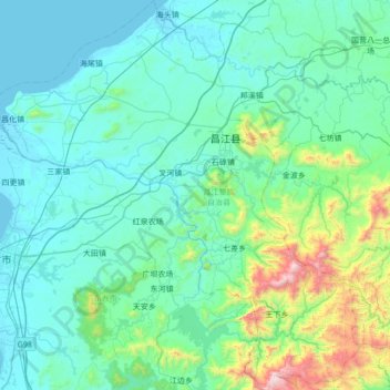
Name: 昌江黎族自治县 topographic map, elevation, terrain.
Location: 昌江黎族自治县, 海南省, 中国 (18.87877 108.64079 19.52619 109.28974)
Average elevation: 212 m
Minimum elevation: -2 m
Maximum elevation: 1,632 m
Other topographic maps
Click on a map to view its topography, its elevation and its terrain.