
Thank you for supporting this site ❤️
Make a donation
Make a donation
Waterville topographic map
Click on the map to display elevation.
Thank you for supporting this site ❤️
Make a donation
Make a donation
About this map
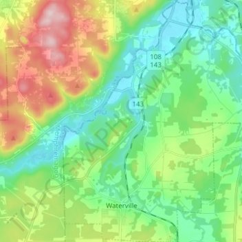
Name: Waterville topographic map, elevation, terrain.
Location: Waterville, Coaticook (MRC), Estrie, Quebec, J0B 3H0, Canada (45.26395 -71.92083 45.35087 -71.81586)
Average elevation: 235 m
Minimum elevation: 144 m
Maximum elevation: 432 m
Thank you for supporting this site ❤️
Make a donation
Make a donation
Other topographic maps
Click on a map to view its topography, its elevation and its terrain.