
Thank you for supporting this site ❤️
Make a donation
Make a donation
Saint-Léandre topographic map
Click on the map to display elevation.
Thank you for supporting this site ❤️
Make a donation
Make a donation
About this map
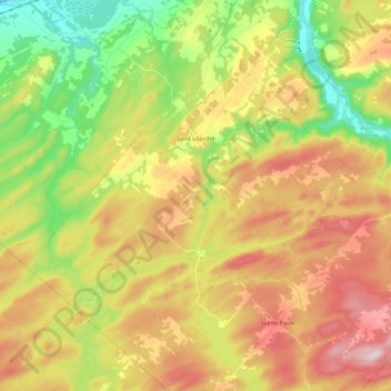
Name: Saint-Léandre topographic map, elevation, terrain.
Location: Saint-Léandre, La Matanie, Bas-Saint-Laurent, Quebec, Canada (48.63425 -67.70586 48.78478 -67.51254)
Average elevation: 190 m
Minimum elevation: 0 m
Maximum elevation: 406 m
Thank you for supporting this site ❤️
Make a donation
Make a donation
Other topographic maps
Click on a map to view its topography, its elevation and its terrain.