
Thank you for supporting this site ❤️
Make a donation
Make a donation
Kenogami Lake topographic map
Click on the map to display elevation.
Thank you for supporting this site ❤️
Make a donation
Make a donation
Kenogami Lake
Kenogami lake is a long lake in the Saguenay–Lac-Saint-Jean region of south-central Quebec, Canada. Situated at an altitude of 150 m (490 ft), the lake is 27 km (17 mi) long and 11 to 102 m (36 to 335 ft) deep. "Kénogami" means "long lake" in the Montagnais dialect and was originally used to refer to Kenogami Lake, Ontario.
Thank you for supporting this site ❤️
Make a donation
Make a donation
About this map
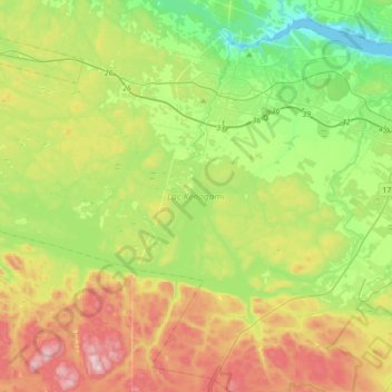
Name: Kenogami Lake topographic map, elevation, terrain.
Average elevation: 200 m
Minimum elevation: 0 m
Maximum elevation: 533 m
Thank you for supporting this site ❤️
Make a donation
Make a donation