
Make a donation
Ban Thung Phlo topographic map
Click on the map to display elevation.
Make a donation
About this map
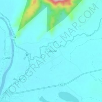
Name: Ban Thung Phlo topographic map, elevation, terrain.
Location: Ban Thung Phlo, Sukhothai Province, Thailand (17.52586 99.76715 17.56586 99.80715)
Average elevation: 87 m
Minimum elevation: 63 m
Maximum elevation: 282 m
Make a donation
Other topographic maps
Click on a map to view its topography, its elevation and its terrain.
Thailand
Thailand comprises several distinct geographic regions, partly corresponding to the provincial groups. The north of the country is the mountainous area of the Thai highlands, with the highest point being Doi Inthanon in the Thanon Thong Chai Range at 2,565 metres (8,415 ft) elevation. The northeast, Isan,…
Average elevation: 156 m
Make a donation
Surin Province
Surin lies at the center of the southern edge of the Khorat Plateau, a relatively low-lying interior region isolated from the rest of Southeast Asia by surrounding mountain ranges. The south of the province is dominated by the Dongrek mountain range, the escarpment of which demarcates the watershed boundaries…
Average elevation: 162 m
Mae Hong Son Province
The Daen Lao Range, in the northernmost portion of the province, marks the northern boundary between Thailand and Burma, while the Dawna Range in the west serves as the boundary between Thailand and Burma. The Thanon Thongchai Range in the east of the province serves as the boundary between the provinces of…
Average elevation: 704 m
Make a donation
Tham Luang-Khun Nam Nang Non Forest Park
Thailand > Mae Sai district > Ban Pha Hi
Average elevation: 661 m
Make a donation
Chiang Mai Province
Chiang Mai province is about 685 km (426 mi) from Bangkok in the Mae Ping River basin and is on average at 300 m (1,000 ft) elevation. Surrounded by the mountain ranges of the Thai highlands, it covers an area of approximately 20,107 km2 (8,000 sq mi). The mountains of the Daen Lao Range…
Average elevation: 649 m
Make a donation
Make a donation
Ratchaburi Province
The area of Ratchaburi province is divided into three parts. First, the border in the west which is shared with Myanmar and is about 60 kilometres (37 mi) long. The second contains the Tenasserim mountains and forests with an elevation of about 200–300 meters. The central area of the province is rich in…
Average elevation: 275 m
Make a donation
Make a donation
Make a donation
Songkhla Province
The province is on the Malay Peninsula, on the coast of the Gulf of Thailand. The highest elevation is Khao Mai Kaeo at 821 meters.
Average elevation: 50 m
Make a donation
Bang Kruai Subdistrict
Thailand > Nonthaburi Province > Bang Kruai District > Bang Kruai Town Municipality
Average elevation: 5 m
Nakhon Nayok Province
The northern part of the province is in the Sankamphaeng Range, the southern prolongation of the Dong Phaya Yen Mountains, with the highest elevation the 1,292-meter-high Yod Khao Kiew. Most of that area is covered by the Khao Yai National Park, 2,166 km2 (836 sq mi), along with three other national parks,…
Average elevation: 183 m
Make a donation
Make a donation
Make a donation
Prachuap Khiri Khan Province
Thailand > Prachuap Khiri Khan Province
Prachuap Khiri Khan covers an area totaling 6,367 square kilometers (2,458 sq mi). The province is on the Kra Isthmus, the narrow land bridge connecting the Malay Peninsula with mainland Asia. The province has the narrowest part of Thailand, just 12.38 km (7.69 mi) from the Gulf of Thailand to the border with…
Average elevation: 105 m
Thanon Nakhon Chai Si Subdistrict
Thailand > Bangkok > Thanon Nakhon Chai Si Subdistrict
Average elevation: 6 m
Make a donation
Make a donation
Bang Chalong Subdistrict
Thailand > Samut Prakan Province > Bang Chalong Subdistrict
Average elevation: 4 m
Maha Phram Subdistrict Municipality
Thailand > Phra Nakhon Si Ayutthaya Province > Bang Ban District
Average elevation: 5 m
Make a donation
Khu Khot Town Municipality
Thailand > Pathum Thani Province > Lam Luk Ka District > Khu Khot Town Municipality
Average elevation: 5 m
Tha Khlong Town Municipality
Thailand > Pathum Thani Province > Khlong Luang District > Tha Khlong Town Municipality
Average elevation: 4 m
Make a donation
Khlong Chik Subdistrict
Thailand > Phra Nakhon Si Ayutthaya Province > Bang Pa-in District > Khlong Chik Subdistrict
Average elevation: 4 m
Phra Pradaeng Town Municipality
Thailand > Samut Prakan Province > Phra Pradaeng District > Phra Pradaeng Town Municipality
Average elevation: 4 m
Make a donation
Make a donation
Mu 3
Thailand > Phra Nakhon Si Ayutthaya Province > Phra Nakhon Si Ayutthaya District > Khlong Suan Phlu Subdistrict
Average elevation: 5 m
Make a donation
Ban Chang Subdistrict Administrative Organization
Thailand > Pathum Thani Province
Average elevation: 4 m
Make a donation