
Thank you for supporting this site ❤️
Make a donation
Make a donation
Noord topographic map
Click on the map to display elevation.
Thank you for supporting this site ❤️
Make a donation
Make a donation
About this map
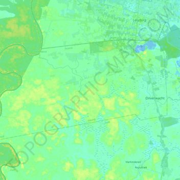
Name: Noord topographic map, elevation, terrain.
Location: Noord, Para, Suriname (5.53337 -55.41692 5.66760 -55.17761)
Average elevation: 7 m
Minimum elevation: -16 m
Maximum elevation: 21 m
Thank you for supporting this site ❤️
Make a donation
Make a donation
Other topographic maps
Click on a map to view its topography, its elevation and its terrain.