
Thank you for supporting this site ❤️
Make a donation
Make a donation
Galveston County topographic map
Click on the map to display elevation.
Thank you for supporting this site ❤️
Make a donation
Make a donation
About this map
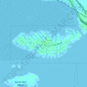
Name: Galveston County topographic map, elevation, terrain.
Location: Galveston County, Texas, USA (29.29259 -94.92950 29.30254 -94.90392)
Average elevation: 0 m
Minimum elevation: -1 m
Maximum elevation: 5 m
Thank you for supporting this site ❤️
Make a donation
Make a donation
Other topographic maps
Click on a map to view its topography, its elevation and its terrain.