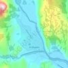
Monte Fitz Roy topographic map
Click on the map to display elevation.
About this map

Name: Monte Fitz Roy topographic map, elevation, terrain.
Location: Monte Fitz Roy, Lago Argentino, Santa Cruz, Argentina (-49.27130 -73.04326 -49.27120 -73.04316)
Average elevation: 2,023 m
Minimum elevation: 1,095 m
Maximum elevation: 3,358 m
Other topographic maps
Click on a map to view its topography, its elevation and its terrain.


Los Glaciares National Park
The park has a cool and moist temperate climate. Mean temperatures range from 0.6 °C (33.1 °F) in winter to 13.4 °C (56.1 °F) in summer although at higher altitudes, the mean annual temperature can be around −3 °C (26.6 °F). The park receives an average annual rainfall of 500 mm (20 in) in the west and…
Average elevation: 752 m