
Thank you for supporting this site ❤️
Make a donation
Make a donation
Turtle Mountain topographic map
Click on the map to display elevation.
Thank you for supporting this site ❤️
Make a donation
Make a donation
About this map
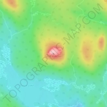
Name: Turtle Mountain topographic map, elevation, terrain.
Average elevation: 137 m
Minimum elevation: 80 m
Maximum elevation: 260 m
Thank you for supporting this site ❤️
Make a donation
Make a donation
Other topographic maps
Click on a map to view its topography, its elevation and its terrain.
Kingston Peninsula
Canada > New Brunswick > Fundy Rural District > Kingston Parish
Average elevation: 79 m
Kingston Peninsula
Canada > New Brunswick > Fundy Rural District > Kingston Parish
Average elevation: 79 m
Thank you for supporting this site ❤️
Make a donation
Make a donation