
Bénoué topographic map
Interactive map
Click on the map to display elevation.
About this map
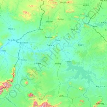
Name: Bénoué topographic map, elevation, terrain.
Location: Bénoué, NO, Cameroun (8.35044 12.84729 10.00274 14.28364)
Average elevation: 328 m
Minimum elevation: 156 m
Maximum elevation: 1,881 m
Other topographic maps
Click on a map to view its topography, its elevation and its terrain.
Parc national de la Bénoué
Parc national de la Bénoué, Tcholliré, Mayo-Rey, NO, Cameroun
Average elevation: 425 m