
Ferndale topographic map
Interactive map
Click on the map to display elevation.
About this map
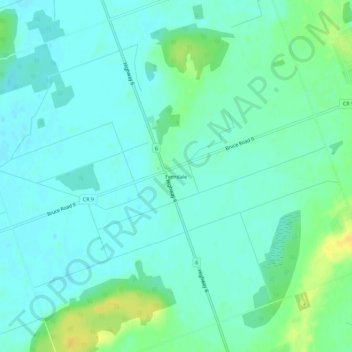
Name: Ferndale topographic map, elevation, terrain.
Location: Ferndale, Bruce County, Ontario, N0H 1W0, Canada (44.95121 -81.30573 44.99121 -81.26573)
Average elevation: 190 m
Minimum elevation: 183 m
Maximum elevation: 207 m