
Thank you for supporting this site ❤️
Make a donation
Make a donation
Dörflingen topographic map
Click on the map to display elevation.
Thank you for supporting this site ❤️
Make a donation
Make a donation
About this map
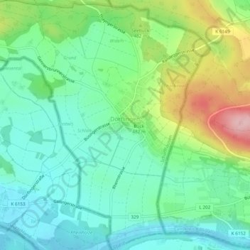
Name: Dörflingen topographic map, elevation, terrain.
Location: Dörflingen, Schaffhouse, 8239, Suisse (47.69069 8.69251 47.72241 8.73629)
Average elevation: 449 m
Minimum elevation: 389 m
Maximum elevation: 587 m
Thank you for supporting this site ❤️
Make a donation
Make a donation
Other topographic maps
Click on a map to view its topography, its elevation and its terrain.