
Thank you for supporting this site ❤️
Make a donation
Make a donation
Rockyford topographic map
Click on the map to display elevation.
Thank you for supporting this site ❤️
Make a donation
Make a donation
About this map
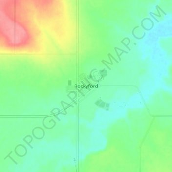
Name: Rockyford topographic map, elevation, terrain.
Location: Rockyford, Wheatland County, Alberta, T0J 2R0, Canada (51.21405 -113.16135 51.25405 -113.12135)
Average elevation: 853 m
Minimum elevation: 826 m
Maximum elevation: 911 m
Thank you for supporting this site ❤️
Make a donation
Make a donation
Other topographic maps
Click on a map to view its topography, its elevation and its terrain.