
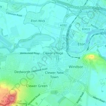
Clewer Village topographic map
Interactive map
Click on the map to display elevation.
About this map
Name: Clewer Village topographic map, elevation, terrain.
Average elevation: 26 m
Minimum elevation: 15 m
Maximum elevation: 90 m
Other topographic maps
Click on a map to view its topography, its elevation and its terrain.
Cookham
Reino Unido > Inglaterra > Windsor and Maidenhead
Cookham, Windsor and Maidenhead, Inglaterra, Reino Unido
Average elevation: 47 m
Windsor
Reino Unido > Inglaterra > Windsor and Maidenhead
Windsor, Windsor and Maidenhead, Inglaterra, Reino Unido
Average elevation: 32 m
Bray
Reino Unido > Inglaterra > Windsor and Maidenhead
Bray, Windsor and Maidenhead, Inglaterra, Reino Unido
Average elevation: 36 m