
Thank you for supporting this site ❤️
Make a donation
Make a donation
Brandon topographic map
Click on the map to display elevation.
Thank you for supporting this site ❤️
Make a donation
Make a donation
About this map
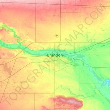
Name: Brandon topographic map, elevation, terrain.
Location: Brandon, Manitoba, R7A 2V8, Canada (49.69111 -100.12089 50.01111 -99.80089)
Average elevation: 409 m
Minimum elevation: 346 m
Maximum elevation: 493 m
Thank you for supporting this site ❤️
Make a donation
Make a donation
Other topographic maps
Click on a map to view its topography, its elevation and its terrain.