
Thank you for supporting this site ❤️
Make a donation
Make a donation
Getmold topographic map
Click on the map to display elevation.
Thank you for supporting this site ❤️
Make a donation
Make a donation
About this map
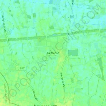
Name: Getmold topographic map, elevation, terrain.
Average elevation: 52 m
Minimum elevation: 46 m
Maximum elevation: 58 m
Thank you for supporting this site ❤️
Make a donation
Make a donation
Other topographic maps
Click on a map to view its topography, its elevation and its terrain.
Lashorst
Deutschland > Nordrhein-Westfalen > Kreis Minden-Lübbecke > Preußisch Oldendorf
Average elevation: 51 m
Hedem
Deutschland > Nordrhein-Westfalen > Kreis Minden-Lübbecke > Preußisch Oldendorf > Hedem
Average elevation: 51 m
32361
Deutschland > Nordrhein-Westfalen > Kreis Minden-Lübbecke > Preußisch Oldendorf
Average elevation: 85 m
Offelten
Deutschland > Nordrhein-Westfalen > Kreis Minden-Lübbecke > Preußisch Oldendorf
Average elevation: 71 m
Thank you for supporting this site ❤️
Make a donation
Make a donation