
Thank you for supporting this site ❤️
Make a donation
Make a donation
Chira topographic map
Click on the map to display elevation.
Thank you for supporting this site ❤️
Make a donation
Make a donation
About this map
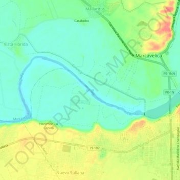
Name: Chira topographic map, elevation, terrain.
Location: Chira, Sullana, Province of Sullana, Piura, Peru (-4.89986 -80.75515 -4.88168 -80.70714)
Average elevation: 50 m
Minimum elevation: 25 m
Maximum elevation: 91 m
Thank you for supporting this site ❤️
Make a donation
Make a donation
Other topographic maps
Click on a map to view its topography, its elevation and its terrain.