
Thank you for supporting this site ❤️
Make a donation
Make a donation
Constitutional Province of Callao topographic map
Click on the map to display elevation.
Thank you for supporting this site ❤️
Make a donation
Make a donation
About this map
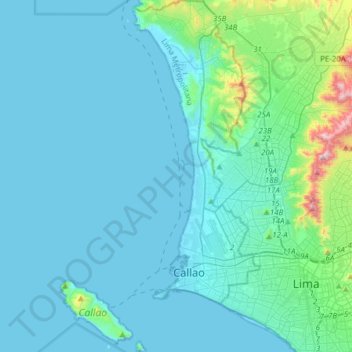
Name: Constitutional Province of Callao topographic map, elevation, terrain.
Location: Constitutional Province of Callao, Peru (-12.12075 -77.25156 -11.81928 -77.07672)
Average elevation: 81 m
Minimum elevation: -3 m
Maximum elevation: 818 m
Thank you for supporting this site ❤️
Make a donation
Make a donation
Other topographic maps
Click on a map to view its topography, its elevation and its terrain.
Thank you for supporting this site ❤️
Make a donation
Make a donation
Thank you for supporting this site ❤️
Make a donation
Make a donation