
Aiguille Rouge topographic map
Interactive map
Click on the map to display elevation.
About this map
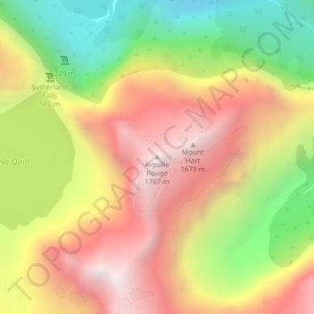
Name: Aiguille Rouge topographic map, elevation, terrain.
Average elevation: 1,058 m
Minimum elevation: 253 m
Maximum elevation: 1,781 m
Other topographic maps
Click on a map to view its topography, its elevation and its terrain.
Milford Sound / Piopiotahi
Nouvelle-Zélande > Southland > Southland District > Fiordland Community
Milford Sound / Piopiotahi, Fiordland Community, Southland District, Southland, Nouvelle-Zélande
Average elevation: 655 m
Te Anau
Nouvelle-Zélande > Southland > Southland District > Fiordland Community
Te Anau, Fiordland Community, Southland District, Southland, 9600, Nouvelle-Zélande
Average elevation: 249 m