
Thank you for supporting this site ❤️
Make a donation
Make a donation
Poing topographic map
Click on the map to display elevation.
Thank you for supporting this site ❤️
Make a donation
Make a donation
About this map
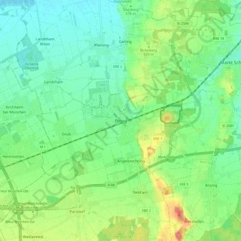
Name: Poing topographic map, elevation, terrain.
Location: Poing, Landkreis Ebersberg, Bavaria, 85586, Germany (48.13205 11.76908 48.21205 11.84908)
Average elevation: 518 m
Minimum elevation: 494 m
Maximum elevation: 570 m
Thank you for supporting this site ❤️
Make a donation
Make a donation
Other topographic maps
Click on a map to view its topography, its elevation and its terrain.