
Tatry topographic map
Interactive map
Click on the map to display elevation.
About this map
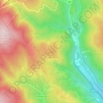
Name: Tatry topographic map, elevation, terrain.
Location: Tatry, okres Pezinok, Région de Bratislava, 900 91, Slovaquie (48.33731 17.21240 48.33741 17.21250)
Average elevation: 422 m
Minimum elevation: 246 m
Maximum elevation: 603 m
Other topographic maps
Click on a map to view its topography, its elevation and its terrain.
okres Pezinok
Slovaquie > Région de Bratislava > okres Pezinok
okres Pezinok, Région de Bratislava, Slovaquie
Average elevation: 262 m