
Thank you for supporting this site ❤️
Make a donation
Make a donation
Franklin topographic map
Click on the map to display elevation.
Thank you for supporting this site ❤️
Make a donation
Make a donation
About this map
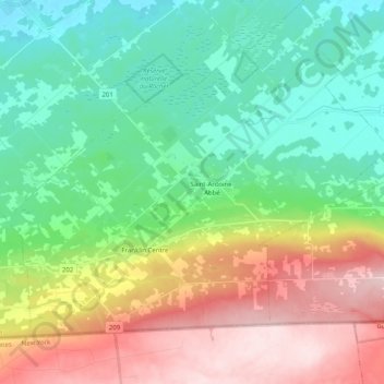
Name: Franklin topographic map, elevation, terrain.
Location: Franklin, Le Haut-Saint-Laurent, Montérégie, Quebec, Canada (44.99729 -73.99618 45.10386 -73.79552)
Average elevation: 147 m
Minimum elevation: 40 m
Maximum elevation: 345 m
Thank you for supporting this site ❤️
Make a donation
Make a donation
Other topographic maps
Click on a map to view its topography, its elevation and its terrain.