
Thank you for supporting this site ❤️
Make a donation
Make a donation
Birch Island topographic map
Click on the map to display elevation.
Thank you for supporting this site ❤️
Make a donation
Make a donation
About this map
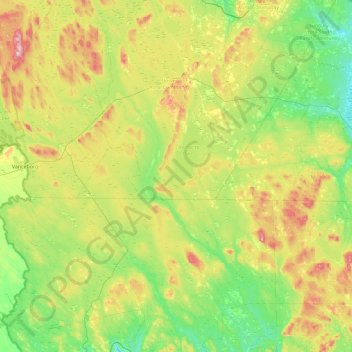
Name: Birch Island topographic map, elevation, terrain.
Average elevation: 124 m
Minimum elevation: 0 m
Maximum elevation: 396 m
Thank you for supporting this site ❤️
Make a donation
Make a donation
Other topographic maps
Click on a map to view its topography, its elevation and its terrain.
Manners Sutton Parish
Canada > New Brunswick > York County > Harvey Rural Community
Average elevation: 138 m