
Thank you for supporting this site ❤️
Make a donation
Make a donation
Lac Gauvreau topographic map
Click on the map to display elevation.
Thank you for supporting this site ❤️
Make a donation
Make a donation
About this map
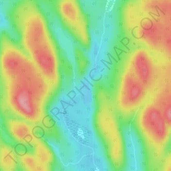
Name: Lac Gauvreau topographic map, elevation, terrain.
Average elevation: 520 m
Minimum elevation: 468 m
Maximum elevation: 580 m
Thank you for supporting this site ❤️
Make a donation
Make a donation
Other topographic maps
Click on a map to view its topography, its elevation and its terrain.
Mont Raoul-Blanchard
Canada > Quebec > La Côte-de-Beaupré > Lac-Jacques-Cartier
Average elevation: 982 m