
Villa El Carmen (Municipio) topographic map
Interactive map
Click on the map to display elevation.
About this map
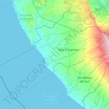
Name: Villa El Carmen (Municipio) topographic map, elevation, terrain.
Location: Villa El Carmen (Municipio), Managua, 16500, Nicaragua (11.75919 -86.85426 12.15711 -86.35574)
Average elevation: 100 m
Minimum elevation: 0 m
Maximum elevation: 784 m
Other topographic maps
Click on a map to view its topography, its elevation and its terrain.