
Thank you for supporting this site ❤️
Make a donation
Make a donation
Kuala Muda topographic map
Click on the map to display elevation.
Thank you for supporting this site ❤️
Make a donation
Make a donation
About this map
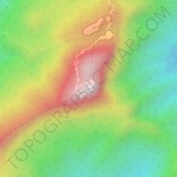
Name: Kuala Muda topographic map, elevation, terrain.
Location: Kuala Muda, Kedah, Malaysia, Gunung Jerai (5.78722 100.43432 5.78732 100.43442)
Average elevation: 800 m
Minimum elevation: 475 m
Maximum elevation: 1,169 m
Thank you for supporting this site ❤️
Make a donation
Make a donation
Other topographic maps
Click on a map to view its topography, its elevation and its terrain.
Thank you for supporting this site ❤️
Make a donation
Make a donation