
Thank you for supporting this site ❤️
Make a donation
Make a donation
Bad Ragaz topographic map
Click on the map to display elevation.
Thank you for supporting this site ❤️
Make a donation
Make a donation
About this map
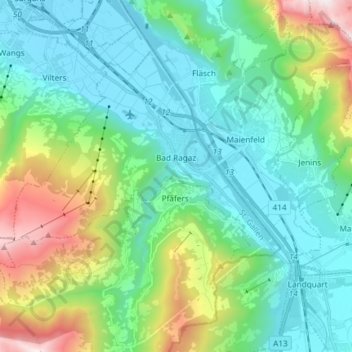
Name: Bad Ragaz topographic map, elevation, terrain.
Location: Bad Ragaz, Wahlkreis Sarganserland, Saint-Gall, 7310, Suisse (46.96060 9.39780 47.03358 9.54557)
Average elevation: 951 m
Minimum elevation: 479 m
Maximum elevation: 2,420 m
Thank you for supporting this site ❤️
Make a donation
Make a donation
Other topographic maps
Click on a map to view its topography, its elevation and its terrain.