
Thank you for supporting this site ❤️
Make a donation
Make a donation
Bronsbergen topographic map
Click on the map to display elevation.
Thank you for supporting this site ❤️
Make a donation
Make a donation
About this map
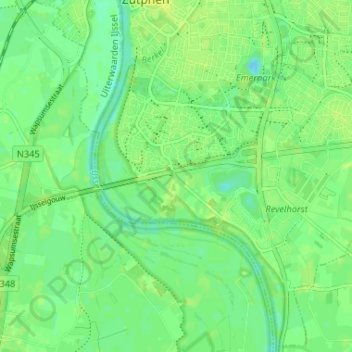
Name: Bronsbergen topographic map, elevation, terrain.
Location: Bronsbergen, Zutphen, Gelderland, Nederland, 7206 JB, Nederland (52.09959 6.18043 52.13959 6.22043)
Average elevation: 8 m
Minimum elevation: -1 m
Maximum elevation: 15 m
Thank you for supporting this site ❤️
Make a donation
Make a donation
Other topographic maps
Click on a map to view its topography, its elevation and its terrain.