
Thank you for supporting this site ❤️
Make a donation
Make a donation
Mount Meru topographic map
Click on the map to display elevation.
Thank you for supporting this site ❤️
Make a donation
Make a donation
Mount Meru
Mount Meru is the topographic centerpiece of Arusha National Park. Its fertile slopes rise above the surrounding savanna and support a forest that hosts diverse wildlife, including nearly 400 species of birds, as well as monkeys and leopards.
Thank you for supporting this site ❤️
Make a donation
Make a donation
About this map
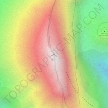
Name: Mount Meru topographic map, elevation, terrain.
Location: Mount Meru, Arusha, Northern Zone, Tanzania (-3.24348 36.74974 -3.24338 36.74984)
Average elevation: 3,881 m
Minimum elevation: 3,068 m
Maximum elevation: 4,539 m
Thank you for supporting this site ❤️
Make a donation
Make a donation
Other topographic maps
Click on a map to view its topography, its elevation and its terrain.