
Yaoundé I topographic map
Interactive map
Click on the map to display elevation.
About this map
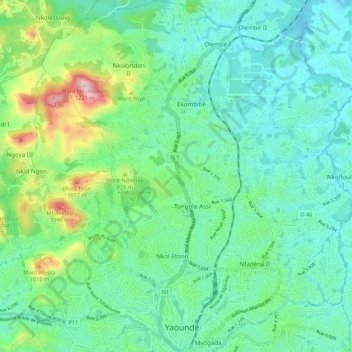
Name: Yaoundé I topographic map, elevation, terrain.
Location: Yaoundé I, CUY, Mfoundi, CE, Cameroun (3.86143 11.47830 3.96920 11.57461)
Average elevation: 757 m
Minimum elevation: 626 m
Maximum elevation: 1,186 m
Other topographic maps
Click on a map to view its topography, its elevation and its terrain.