
Thank you for supporting this site ❤️
Make a donation
Make a donation
Ebikon topographic map
Click on the map to display elevation.
Thank you for supporting this site ❤️
Make a donation
Make a donation
About this map
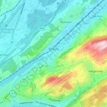
Name: Ebikon topographic map, elevation, terrain.
Location: Ebikon, Lucerne, 6030, Suisse (47.06263 8.29052 47.09527 8.36598)
Average elevation: 489 m
Minimum elevation: 411 m
Maximum elevation: 745 m
Thank you for supporting this site ❤️
Make a donation
Make a donation
Other topographic maps
Click on a map to view its topography, its elevation and its terrain.
Thank you for supporting this site ❤️
Make a donation
Make a donation