
Lanaye topographic map
Interactive map
Click on the map to display elevation.
About this map
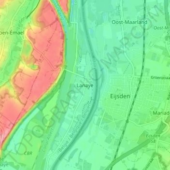
Name: Lanaye topographic map, elevation, terrain.
Location: Lanaye, Visé, Liège, Wallonie, 4600, Belgique (50.76066 5.67444 50.80066 5.71444)
Average elevation: 67 m
Minimum elevation: 32 m
Maximum elevation: 134 m
Other topographic maps
Click on a map to view its topography, its elevation and its terrain.