
Thank you for supporting this site ❤️
Make a donation
Make a donation
Jessop topographic map
Click on the map to display elevation.
Thank you for supporting this site ❤️
Make a donation
Make a donation
About this map
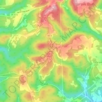
Name: Jessop topographic map, elevation, terrain.
Location: Jessop, Preston County, West Virginia, 26444, United States (39.39842 -79.77756 39.43842 -79.73756)
Average elevation: 616 m
Minimum elevation: 528 m
Maximum elevation: 702 m
Thank you for supporting this site ❤️
Make a donation
Make a donation
Other topographic maps
Click on a map to view its topography, its elevation and its terrain.
Thank you for supporting this site ❤️
Make a donation
Make a donation
Thank you for supporting this site ❤️
Make a donation
Make a donation