
Mellieha topographic map
Interactive map
Click on the map to display elevation.
About this map
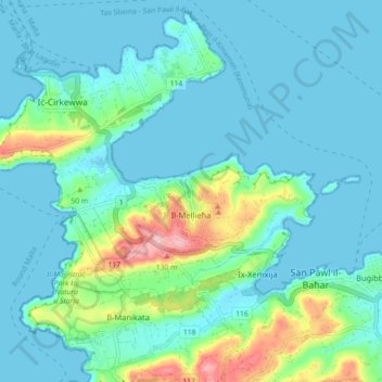
Name: Mellieha topographic map, elevation, terrain.
Location: Mellieha, Northern Region, Malta (35.93064 14.31891 35.99830 14.40774)
Average elevation: 28 m
Minimum elevation: -1 m
Maximum elevation: 151 m
Other topographic maps
Click on a map to view its topography, its elevation and its terrain.