
District de Sucheng topographic map
Interactive map
Click on the map to display elevation.
About this map
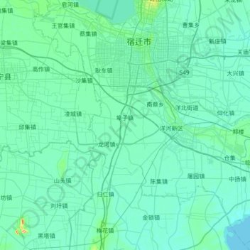
Name: District de Sucheng topographic map, elevation, terrain.
Location: District de Sucheng, Suqian, Jiangsu, Chine (33.56915 118.02243 34.03191 118.60499)
Average elevation: 21 m
Minimum elevation: 10 m
Maximum elevation: 152 m
Other topographic maps
Click on a map to view its topography, its elevation and its terrain.
Lianyungang
Chine > Jiangsu > Lianyungang
Lianyungang, 海州区 (Haizhou), 连云港市, Jiangsu, Chine
Average elevation: 17 m