
Ontario Island topographic map
Interactive map
Click on the map to display elevation.
About this map
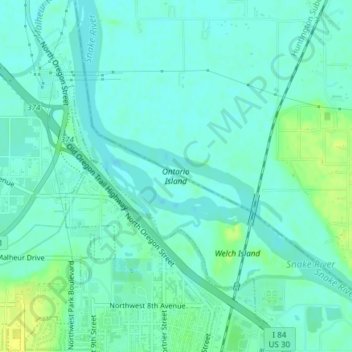
Name: Ontario Island topographic map, elevation, terrain.
Location: Ontario Island, Payette County, Idaho, United States (44.04309 -116.97184 44.04809 -116.95725)
Average elevation: 655 m
Minimum elevation: 649 m
Maximum elevation: 667 m
Other topographic maps
Click on a map to view its topography, its elevation and its terrain.
New Plymouth
United States > Idaho > Payette County
New Plymouth, Payette County, Idaho, 83655, United States
Average elevation: 689 m
Fruitland
United States > Idaho > Payette County
Fruitland, Payette County, Idaho, 83619, United States
Average elevation: 666 m
Sand Hollow
United States > Idaho > Payette County
Sand Hollow, Payette County, Idaho, United States
Average elevation: 756 m