
Thank you for supporting this site ❤️
Make a donation
Make a donation
Fault topographic map
Click on the map to display elevation.
Thank you for supporting this site ❤️
Make a donation
Make a donation
About this map
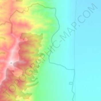
Name: Fault topographic map, elevation, terrain.
Location: Fault, Churchill County, Nevada, United States (39.54485 -118.20626 39.64547 -118.17230)
Average elevation: 1,501 m
Minimum elevation: 1,067 m
Maximum elevation: 2,666 m
Thank you for supporting this site ❤️
Make a donation
Make a donation
Other topographic maps
Click on a map to view its topography, its elevation and its terrain.