
Thank you for supporting this site ❤️
Make a donation
Make a donation
Pyramid Mountain topographic map
Click on the map to display elevation.
Thank you for supporting this site ❤️
Make a donation
Make a donation
About this map
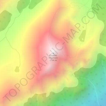
Name: Pyramid Mountain topographic map, elevation, terrain.
Location: Pyramid Mountain, Municipality of Jasper, Alberta, Canada (52.95105 -118.14945 52.95115 -118.14935)
Average elevation: 2,152 m
Minimum elevation: 1,446 m
Maximum elevation: 2,756 m
Thank you for supporting this site ❤️
Make a donation
Make a donation
Other topographic maps
Click on a map to view its topography, its elevation and its terrain.