
Thank you for supporting this site ❤️
Make a donation
Make a donation
Dearborn County topographic map
Click on the map to display elevation.
Thank you for supporting this site ❤️
Make a donation
Make a donation
About this map
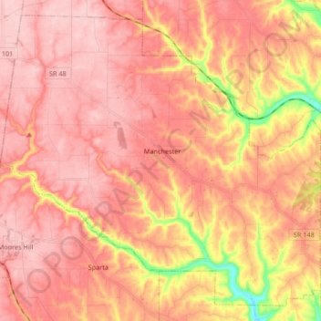
Name: Dearborn County topographic map, elevation, terrain.
Location: Manchester Township, Dearborn County, Indiana, USA (39.08985 -85.09594 39.20618 -84.93032)
Average elevation: 265 m
Minimum elevation: 147 m
Maximum elevation: 315 m
Thank you for supporting this site ❤️
Make a donation
Make a donation
Other topographic maps
Click on a map to view its topography, its elevation and its terrain.