
O Trebello topographic map
Interactive map
Click on the map to display elevation.
About this map
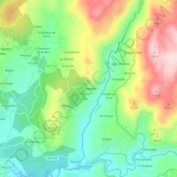
Name: O Trebello topographic map, elevation, terrain.
Average elevation: 502 m
Minimum elevation: 349 m
Maximum elevation: 742 m
Other topographic maps
Click on a map to view its topography, its elevation and its terrain.
Aguasantas
Spanje > Galicië > Pontevedra
Aguasantas, Cerdedo-Cotobade, Pontevedra, Galicië, Spanje
Average elevation: 487 m