
Thank you for supporting this site ❤️
Make a donation
Make a donation
Lac Lilloet topographic map
Click on the map to display elevation.
Thank you for supporting this site ❤️
Make a donation
Make a donation
About this map
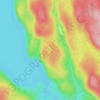
Name: Lac Lilloet topographic map, elevation, terrain.
Average elevation: 323 m
Minimum elevation: 236 m
Maximum elevation: 436 m
Thank you for supporting this site ❤️
Make a donation
Make a donation
Other topographic maps
Click on a map to view its topography, its elevation and its terrain.
Mont de la Tête de Brochet
Canada > Quebec > Urban agglomeration of La Tuque > La Tuque
Average elevation: 413 m
Thank you for supporting this site ❤️
Make a donation
Make a donation
Thank you for supporting this site ❤️
Make a donation
Make a donation