
Toyota topographic map
Interactive map
Click on the map to display elevation.
About this map
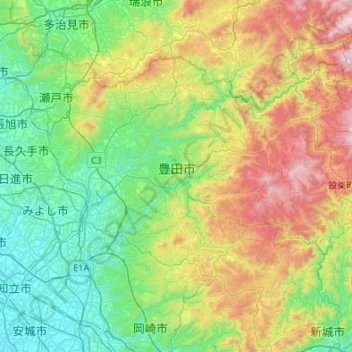
Name: Toyota topographic map, elevation, terrain.
Location: Toyota, Prefectura de Aichi, Japón (34.99061 137.04006 35.29116 137.58113)
Average elevation: 359 m
Minimum elevation: 2 m
Maximum elevation: 1,222 m
Other topographic maps
Click on a map to view its topography, its elevation and its terrain.