
Seto topographic map
Interactive map
Click on the map to display elevation.
About this map
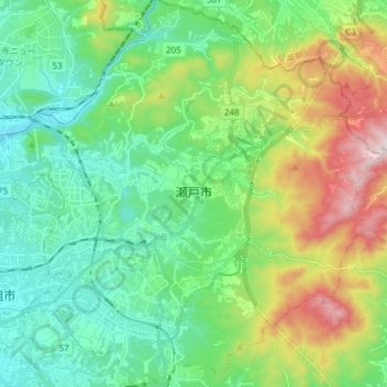
Name: Seto topographic map, elevation, terrain.
Location: Seto, Prefectura de Aichi, Japón (35.17880 137.04843 35.30165 137.18949)
Average elevation: 225 m
Minimum elevation: 32 m
Maximum elevation: 692 m
Other topographic maps
Click on a map to view its topography, its elevation and its terrain.